










ORGANIZERS
 Onshirin Regional Public Organization |
 Research Institute for Humanity and Nature |
 International Association for the Study of the Commons |
REGISTRATION OFFICE
c/o Convention Linkage, Inc.
Sanbancho KS Bldg.
2 Sanbancho, Chiyoda-ku
Tokyo 102-0075, Japan
Phone: +81-3-3263-8695
Fax: +81-3-3263-8693
Email: info@iasc2013.org

REGISTRATION
FT1: KOSUGE -- Collaboration in environmental education: exchange between village residents and students in Kosuge Village on the Tama River, western Tokyo Prefecture
Cost ¥7,000 including lunch
total driving distance 150 km
duration not sure yet
capacity 20 persons
Coordinator Shingo Ishizaka, Tokyo University of Agriculture
Located in the headwaters area of the Tama River (which flows into Tokyo), Kosuge is considered one of the best “headwaters villages” in Japan for maintaining excellent environmental quality in its water sources, which serve the Tokyo metropolitan area. But it is also a typical rural mountain village, strained by the decline and aging of its population. In recent years, through collaborative programs between the village and academic institutions, the village has laid the foundation for a unique village development project of exchange and cultural tourism, to attract young people as visitors. This project is already displaying positive impact in revitalizing both the local economy and the community itself.
Kosuge Village still retains its own food culture, lifestyle, and traditional knowledge systems, all of which are deeply rooted in its natural surroundings. But its location close to a huge metropolitan area means that it can offer many others the opportunity to experience these cultural features. Simply by having preserved its commons in good condition, Kosuge becomes an attractive destination for urban visitors. Thus the commons are now serving additional purposes, providing concrete environmental services in the form of a vital source of fresh water for Tokyo, but more abstractly also to provide environmental education and a greater appreciation of environmental linkages and the dependence of all people on a healthy natural environment. Through exchange with young visitors, villagers encounter the innovative ways of thinking and youthful energy brought in by students who visit their area. Both students and villagers build a good relationship with each other that is key in the area’s revitalization process. In turn, the visiting students with little formative experience in close contact with nature receive the opportunity to take part in hands-on activities in a village, with the various resources found in a rural headwaters area. Programs like those in Kosuge are expected to contribute to building the community of activists in Japan who will work actively to establish a more environment-friendly society. At the same time, such programs, aimed at facilitating local revitalization and public understanding of rural life, can lead to greater appreciation and conservation of the time-honored customs and traditions seen in the Japan of an earlier era.
 |
||
|---|---|---|
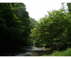
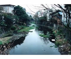
| Kosuge River, the headwaters of the Tama River before it flows to Tokyo |
FT2: FUJI GRASSLANDS -- Management and control of common grasslands at the northern foot of Mount Fuji.
Cost ¥3,000 (half-day trip without lunch)
Total driving distance 20-30km
Duration 3.5 hours, 8:30am – 12:00noon
Capacity 40 persons
Coordinator Hitoshi Ikeguchi, Yamanashi Institute of Environmental Sciences
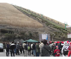
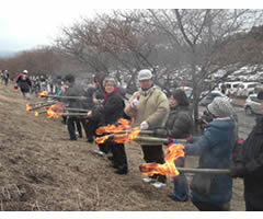
Decades ago, villagers used their grassland commons for extractive purposes: to graze animals, to gather fodder for stall-feeding of animals, as a source of leaf litter for fertilizer, and as a source of thatch for the roofs of their houses. In addition, the grassland meadows also produce important cultural and aesthetic values, which also attract visitors. Enjoying the grassland areas, especially autumn grasslands that include the seven autumn wildflowers, was once a thriving part of Japanese culture, as was the ornamental use of susuki grass for the moon-viewing tradition. Due to population increase and urban development over the last century, land use for semi-natural second-growth grasslands seems to be decreasing throughout Japan, but the grasslands at the northern foot of Mount Fuji in Yamanashi Prefecture have been better preserved than any other in Japan. The commoners who own access rights to these grasslands control and maintain them by annual burning (“noyaki”), an activity that also reinforces their claims to the portion of the grasslands that were confiscated by the Japanese military in 1936 and are still used by the Japan Ground Self-Defense Forces. The north Fuji grasslands include the grasslands of Nashigahara (this area is also used as a training area by Japan’s Self-Defense Forces), Panorama-dai in Lake Yamanaka Village, and Takazasuyama in Oshino Village. Conference participants will visit these areas and receive basic information about the geological features, past disasters, the history of Mt. Fuji’s northern base, as well as the patterns of ownership and management of the commons. Participants will also visit Panorama-dai to observe usage and management of these grass-gathering commons and will also learn about the biodiversity and cultural significance of the environment on Fuji’s grasslands.
 |
|---|
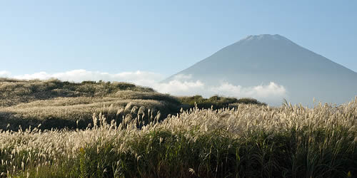
| Grasslands of north Fuji |
FT3: DŌSHI FISHERY -- Restoration of commons lost to river development: Dōshi Village in Yamanashi Prefecture created a community fishery association as compensation for loss of sweetfish [ayu] due to dams.
Cost ¥6,000 including lunch
Total driving distance 70km
Duration ???
Capacity 40 persons
Coordinator Keiko Izumi, Tsuru University
Dōshi-mura in Yamanashi Prefecture is a village situated at a headwaters area. It has a population of 1,900 people, 30% of whom are over 65 years of age. The Dōshi River flows through the village, and for approximately 120 years it has served as a source of water for the seaport city of Yokohama and the industrial belt of Kanagawa Prefecture. Although the Dōshi used to be well-known for its plentiful supply of amphidromous sweetfish (known as ayu in Japan), construction of the Dōshi Dam in 1949 and the Shiroyama Dam in 1965 prevented the ayu, which travel between river and sea, from returning to the Dōshi headwaters. Thus the dams essentially depleted the river of its fish stocks, including the ayu. Creation of public works through government use of eminent domain to confiscate property requires compensation to property owners. The village, as owner of the ayu fishery commons that would be eradicated by the dams, did not choose to receive the conventional lump-sum cash payment as compensation for losses. Instead, Dōshi Village chose to establish a fishery association – a new commons -- that all village households would participate in. An additional component of the compensation scheme was regular provision of young sweetfish stock for Dōshi’s new fishery above the dams, so that recreational fishers would continue to visit the headwaters for fishing and bring income to Dōshi village. Rather than allowing the appetites of water users downstream from the village in the urban portion of Kanagawa prefecture to destroy their resources, the local residents of Dōshi decided instead to re-establish a fishery and to protect it thereafter. The effect of crisis (dam-building) on Dōshi village was to transform a loosely managed fishery commons into a cohesive and much stronger cooperative organization that fought to re-create its lost resource and continues to manage it today. The two key people in establishing the association were Tsuyakichi Yukawa, a fisherman, and Enzo Sato, a member of the village assembly. Between them, Yukawa and Sato developed persuasive arguments on both ecological and politico-economic perspectives of this issue. Field trip participants will be able to meet relatives of the two founding members, learn about the creation of this new common property arrangement and its relationship to pre-existing commons in Dōshi, and hear about the current challenges facing the fishery association today.
 |
||
|---|---|---|
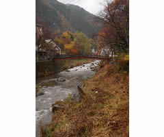
| Dōshi river, running through Dōshi village. |
FT4: TSURU HYDROPOWER -- Small-scale hydropower generation in Tsuru: Traditional and Present-day.
Cost ¥4,000 including lunch
Total driving distance 40km
Duration 8 hours, 8:30am – 4:30pm
Capacity 20 persons.
Coordinator Kazue Kagawa of Mizukan Center of Water Culture
http:/www.mizu.gr.jp/center/
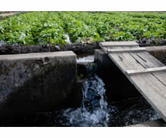
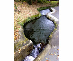
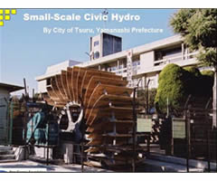
Tsuru is blessed with spring waters from Mount Fuji, and rights to use these waters were the common property of the original villages that now make up Tsuru City. Residents of the city traditionally used this abundant pure clean water in the production of silk fabric and other industries that could rely on water wheels to generate electric power. One noteworthy feature of Tsuru is the fact that these communities managed their water not just for agricultural purposes but also for commerce and industry. The second hydropower station to be built in Yamanashi Prefecture (after one established in the larger city of Kofu), Tsuru’s hydropower station was constructed here in 1905. Although the station was shut down for some time, studying its history has been very helpful in recreating the small hydropower station that is presently being used, as part of a major nationwide effort to reduce dependence on fossil fuels and shift to renewable forms of energy. In addition to visiting the station and learning about the history and management of the system, participants will make their way along present-day and very old water channels that have been well preserved to get an idea of how Tsuru communities and citizens have used this common-pool resource in their daily lives throughout history.
 |
 |
 |
|---|---|---|
FT5: FUJIKŌ & ECOTOURISM -- The long climb from mass to community-based tourism; following in the footsteps of the Fujikō).
Cost ¥4,000 including lunch
Total driving distance 20-30km
Duration 8 hours, 8:30am – 4:30pm
Capacity 20 persons
Coordinator Yukimasa Kato (Nihon University).
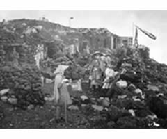
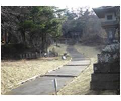
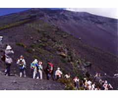
Mount Fuji is located in one of the world’s most visited national parks with an estimated 100 million annual visits. In 2007, Fuji was added to the tentative list of UNESCO World Cultural Heritage sites, encouraging greater volumes of visitors still, including some 300,000 climbers every summer. The interest in climbing Mount Fuji is not recent. By the 16th century, Mount Fuji was considered sacred, and religious pilgrims devoted to the deities believed to be enshrined on Mount Fuji created a society called Fujikō, whose members raised funds to help finance the climb for a few of their members, by rotation. Thus the early Fujikō cult was actually a commons as well. The devout often started their climb in the villages (particularly Upper Yoshida) that now compromise Fujiyoshida City – whose residents were and whose descendants still are Kitafuji commoners -- staying overnight in lodgings for pilgrims like the Oshi House. Then they made their ascent through the Kitafuji commons, which extends almost to the top of Mount Fuji. (The summit of Mount Fuji is owned by the Fujisan Hongu Sengen Taisha (a major shrine), which won the land from the government in a Supreme Court ruling of 1974, though the government did not hand the land over until 2004.) Providing guides and equipment for the Fujiko climbers became a source of income for Kitafuji commoners. Like the Fujikō pilgrims of yesteryear, today’s climbers take advantage of a short summer window, ascending under cover of darkness to see sunrise from the summit. But that is where the similarities end: where white-robed pilgrims once walked hundreds of kilometres to climb Fuji, today’s ‘bullet’ tours are whisked up to the 5th step where they can climb up and down overnight. Yet this 21st century style of tourism creates a number of management flashpoints, such as trail congestion and toilets, and leaves climbers with little concept of Fuji’s cultural heritage. Meanwhile, UNESCO designation entails rising management costs, while socio-economic benefits for the local community are unclear. This tour will be a chance to hear their side of the story; participants will pass through the Kanadorii Gate on to Fuji’s sacred soil, then visit one of the best-preserved pilgrim inns and meet Togawa-san, one of the last remaining descendants of Oshi guides. We will continue to Fuji Sengen, the shrine where purification rituals were conducted prior to climbing, then hike a section of the original trail used by pilgrims to climb Fuji. This field trip offers an opportunity to meet local community organizations directly involved with conservation of cultural heritage sites such as the Oshi House, and gain insights into attempts to resurrect community-based tourism. (On the Fukikō and the shrine, see http://www.fuji-hongu.or.jp/sengen/pdf/sengen.pdf.)
 |
 |
 |
|---|---|---|
| Fujikō climbers in the Meiji period | Umagaeshi where the ascent begins | Present-day climbers |
FT6: HAYAKAWA SLASH AND BURN -- Changing lifestyles in mountain villages
Cost ¥7,000 including lunch
Driving distance 180km
Duration unknown
Capacity 40 persons
Coordinator Daisuke Kurauchi of Japan Upper River non-profit.
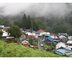
Hayakawa Town is located in southwest Yamanashi Prefecture at the prefectural boundary shared with Shizuoka. Situated in the region of Japan’s Southern Alps, it embraces mountains that reach 3,000 meters above sea level. The Haya River flows through the mountain villages of the valley with its headwaters at Mount Kita (Japan’s second tallest mountain, after Mount Fuji). Ninety-six percent of the area is covered in mountain forests. With just 1,200 residents living there, Hayakawa is known throughout Japan for being the most sparsely populated "town" in Japan (all settlements with smaller populations are “villages”). It is actually composed of 19 villages that merged into 6 villages in the 19th century and then merged again into Hayakawa town in the subsequent wave of government-inspired amalgamations in 1956. Hayakawa commoners resisted the government’s attempts to take their commons and held onto them as property wards.
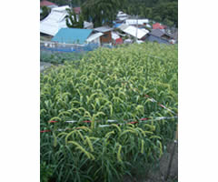
Participants on this field trip will visit the Narada and Mogura settlements, two of the hamlets or Tokugawa-era villages comprising Hayakawa Town. Narada has actually seen very few visitors as it is rather isolated; slash-and-burn techniques were practiced here on Hayakawa’s commons until the mid-1960s. Mogura is detached from the main roads of Hayakawa Town, and its villagers have painstakingly preserved many of the traditional events unique to this area.
The visit to these two settlements aims to introduce participants to the traditional mountain-village lifestyle as well as present the history of its development and present-day problems, like depopulation and aging, which threaten the continuation of this culture.
 |
 |
 |
|---|---|---|
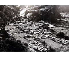
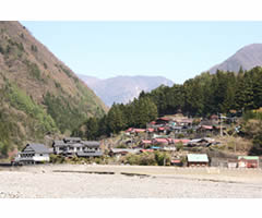
| Mogura today | Grains planted in Mogura | Narada in the past |
 |
 |
|
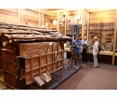
| Narada today | Narada’s museum |
FT7: FUJI TEA -- Tea plantations and other land use systems at Mt. Fuji’s southern foot
Cost ¥7,000 including lunch
Total driving distance 140km
Duration 9.5 hours, 8:00am – 17:30pm
Capacity 20 persons.
Coordinator Takuya Inoue of Fujiyoshida City Administration.
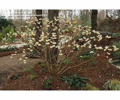
The slope at the southern foot of Mount Fuji was once used as a common-use kayaba (where grass for thatching is grown). In the Meiji period (1867-1912), the commoners divided much of this commons into individual plots for each commoner household, some of it permanently titled to individuals and some of it remaining residual property of the commoners as a whole in the form of property wards. [Property wards are a legal creation reluctantly devised by the government after massive protests to allow villages to maintain ownership of their commons – forest, meadow, water rights, hot spring rights, fisheries rights, etc – even after amalgamation into larger municipalities. The government’s hope was that in amalgamating villages into larger units, it could simultaneously extinguish the commons and acquire property for the government, but massive protest in defense of common access rights [iriai-ken] prevented this strategy from working. Villages that fought for their commons managed to maintain them as “property wards” or zaisanku.].
For the last century, forestry has flourished, oriental paperbush (raw material for high quality Japanese paper)has also become a major product, and the tea industry has thrived. Shizuoka produces 45% of Japan’s tea.
One major aim of this field trip is to examine land-use cases at the southern foot of Mount Fuji. Specialists will give lectures on tea cultivation and the history of tea manufacturing in the Mount Fuji area of Shizuoka Prefecture. Participants will visit a tea plantation and a tea factory, and create new friendships with the local people. They will also experience picking tea and hand rolling it, immersing themselves in the various aspects of Japan’s tea culture.
 |
 |
|
|---|---|---|
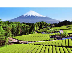
| Geometrical perfection in tea plantations | Oriental paperbush Edgeworthia chrysantha |
FT8: SURUGA BAY SHRIMP -- Sakura shrimp for local revitalization in the community of Yui on Suruga Bay
Cost ¥7,000 including lunch
Total driving distance 180km
Duration 10 hours, 8:00am-6:00pm
Capacity 40 persons.
Coordinators Takahiro Kobayashi, Ri Ginki, and Rintaro Ono of Tokai University.
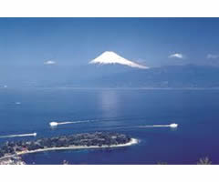
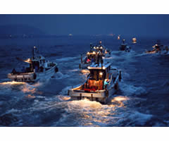
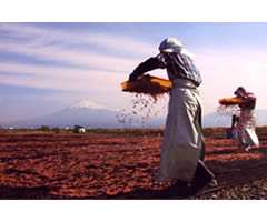
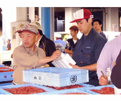
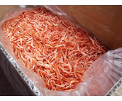
This field trip will visit the coastal fisheries of Shizuoka Prefecture, and particularly the shrimp fishery of Yui, an area of the city of Shimizu. This area is known for its successful management of the fisheries commons and exemplary co-management. Here, a unique variety of shrimp known as sakura shrimp, sakura-ebi or Sergia lucens, (which is found only in Suruga Bay) has become a crucial element of the local revitalization program. Participants in this field trip will be able to meet local fishers and members of the Yui Port Fishery Association, of the Yui Sakura-ebi Commercial and Industrial Association and from local wholesale and retail sales outlets to discuss topics such as sakura shrimp fishing, processing, sales and distribution, food culture, and local community revitalization. They will stroll along Sakura-ebi Street and enjoy local sakura shrimp cuisine. Participants will also visit the Shimizu Fish Market, riverside markets, the Dream Plaza complex of shops and residences, and finally, take a scenic cruise of beautiful Suruga Bay. On the Sakura-ebi fishery of Suruga bay, see
ftp://ftp.fao.org/docrep/fao/010/a1497e/a1497e16.pdf
 |
 |
 |
|---|---|---|
| Fishing in Suruga bay | Drying the shrimp | |
 |
 |
|
| Shrimp market | Sergestes lucens |
FT9: MISHIMA WATER -- Study tour to an advanced field-model of environmental and community regeneration: Mishima, the Water City blessed with Mt. Fuji’s spring water
Cost ¥7,000 including lunch
Total driving distance 120km
Duration unknown
Capacity 40 persons.
Coordinator Tohoyiro Watanabe of Grouund work Mishima.
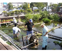
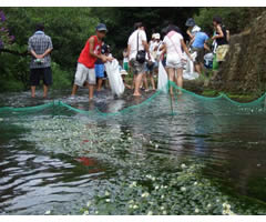
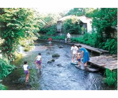
Mishima, situated at the base of Mount Fuji, was once blessed with an abundant groundwater supply. Since 1964, however, the groundwater supply has been decreasing – the water table is falling – due both to the expanding population and especially to pumping by the city’s expanding industries. In addition, the city’s rivers have been contaminated with household wastewater, virtually turning them into dumpsites. In response to worsening environmental conditions and the energy of local citizens concerned about environmental losses from water quality to fireflies, Groundwork Mishima was formed in 1992 from eight civic groups in the city to create a partnership among citizens, local government and companies in the recovery of the natural aqueous environment of the water city. This is essentially the creation of a new commons in response to a mutual problem of overuse. The results of these efforts today can be seen all around, crystal-clear streams, the dancing of fireflies and happy children playing by the riverside. Environmental regeneration also attracts tourists and the once declining shopping streets have been revitalized. Groundwork Mishima has even created international linkages with environmental groups in other countries (installing biotoilets at Mount Fuji and Mount Rainier, and Angkor Wat!) Participants on this field trip will learn, through the first-hand experience of activists in Groundwork Mishima, strategic approaches to environmental and community regeneration and the know-how necessary to carry it out. Participants will also visit a historic well and a spring-fed pond, from which they will most definitely be able to sense the wonder and charm of Mishima, the Water City.
 |
 |
 |
|---|---|---|
| Producing seedlings of the Mishima Baikamo for replanting | Students restoring the rare Mishima Baikamo plant (an indicator of high water quality) to its original habitat, now free of the pollution that killed it off in the 1960s. | Gembei river in Mishima before restoration |
 |
||
| Genbei river after restoration |
FT10: IZU GEOPARKS ECOTOURISM -- Harmony between tourism and community-based resource management: Izu Peninsula tries to become a member of the Global Geoparks Network.
Cost ¥9,000 including lunch
Driving distance 190km
Duration 10 hours, 8:00am to 6:00pm
Capacity 40 persons.
Coordinators: Yuji Hirokawa of KitaKyushu University and Tatsuya Suzuki of Ryukoku University.
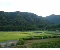
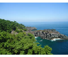
Due to the eruptions of Mount Fuji, Izu Peninsula in Shizuoka Prefecture possesses unique geographical characteristics. Grasses for thatching grow abundantly here and many fisheries and hot springs operate, all of which have been traditionally used and managed as commons under local community initiatives. These same resources, the blessings of Mount Fuji, have also proven to be attractive today for developing tourism as an additional economically valuable use. The area welcomes many outsiders, including tourists, into its local communities, but the kayaba (thatching-grass lands), fishing grounds and hot spring resources are still all managed under the local community initiative as common property. Field Trip participants will come to understand how local communities have been able to continue with their land-use and resource-management initiatives while still maintaining a balance with an active and successful tourism industry. This field trip demonstrates how maintaining the commons through the period of industrialization can provide precious environmental resources for an expanding group of beneficiaries as well as economic rewards to the commoners who undertake the care and protection of these resources through such vast economic change.
 |
 |
 |
|---|---|---|
 |
||
FT11: FUJI THATCH AND FORESTS -- Use of thatch (kayaba) grasslands and forests at the foot of Mt. Fuji
Cost ¥7,000 including lunch
Driving distance 110 km
Duration 10 hours, 8:00am to 6:00pm
Capacity 40 persons.
Coordinator Kazunobu Ikeya, National Museum of Ethnology.
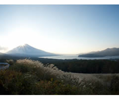
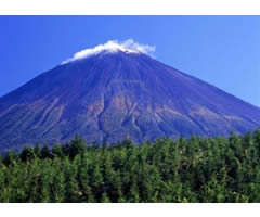
Participants will conduct a journey around at the foot of Mt. Fuji. There will be time to look at diverse uses of forests for timber, and grasslands for thatch gathering, grazing, and recreation. We will visit Gotenba and other places in Shizuoka prefecture, and experience Japan’s largest grasslands. There will be chances to investigate the history, politics, present status and problems related to grassland/forest management with the help of representatives from local property wards [zaisanku], a legal creation to allow hamlets to maintain legal ownership of their commons even through the process of municipal amalgamation, which the Japanese government has insisted on doing three times during the past 150 years. In Japan, kaya-ba (grass- fields) have played an important role in supplying grassland products; the cyclical use of natural resources is closely connected to farming and rural life. Gotenba presently accounts for approximately 70% of the country’s kaya production. Moreover, due to its high quality, its share is more than 90% in the cultural heritage sector of the market. Since the mid-20th century, the Kitafuji commons have become highly politicized because the Japanese Imperial Army and later the postwar Self-Defense Forces confiscated this area as a maneuvering ground. Local residents protested for decades but finally won confirmation of their common-access rights in the Supreme Court of Japan, which ruled, in a finding against the national government, that communities with a demonstrable record of ownership and management of their commons still possess those rights even if the government uses eminent domain to take ownership of the land itself. The SDF uses the grasslands for training purposes, but the commoners of Kitafuji continue to conduct the annual burning (noyaki) of the grasslands and of course maintain their use as well as full ownership of other areas of their traditional commons. This trip will give participants an understanding of the current status of grassland/forest management systems, complex organizational arrangements, and the continuing politicization of the commons.
 |
 |
|
|---|---|---|
FT12: KONOHANA ECOVILLAGE -- Experience of “Ecovillage” – A Model of Farm Life Based on Common Ownership
Cost ¥7,000 including lunch
Driving distance 160km
Duration 9 hours
Capacity 40 persons.
Coordinator Michiyo Furuhashi, Konohana family farm.
Japanese society as a whole is aging, but none more rapidly than the rural population – many rural communities are essentially desolated as young people migrate to the cities. The Konohana Family is an intentional community of 85 members (average age is 33) have decided to lease 18 hectors of farming land from local neighbors, produce 260 varieties of vegetables and grains including millet, and tea without chemicals. They have achieved relatively self-sufficient and sustainable lives as a result.
Konohana was established in 1994 on 16 hectares of land near Fujinomiya City in Shizuoka prefecture (near the Kitafuji conference site). Konohana members see all people as members of one big family, beyond formal kinship ties. Members’ social and farming practices allow it to operate with less than ¥300,000 (equivalent to US$3,250 USD in Feb2013) annually per person. Members have reduced their environmental impact to one third of the average per-person impact for the rest of Japan, according to the Ecological Footprint simplified survey. Behind its life and initiatives is deeply grounded spirituality that makes the thorough sharing possible.
The Konohana Family is becoming known, nationally and internationally, as a model Ecovillage [a commuhity of people who share values concerned with society, economy, culture, and particularly environmental protection and sustainable living]. On this trip, participants will experience the spirituality and a system of this living from various perspectives with a guided tour of the fields and facilities, a presentation, discussion with members, vegetarian lunch that is made of self-produced ingredients, and a concert by the community band with original music. We hope participants will seek possibilities for a new social model based on common ownership and collective action.
Please refer to the 6-minute-video created by United Nation University Media Team:
English version: OurWorld2.0 http://ourworld.unu.edu/en/konohana/
Japanese Version: OurWorld2.0 http://ourworld.unu.edu/jp/konohana/
 |
 |
 |
|---|---|---|
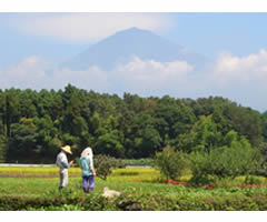
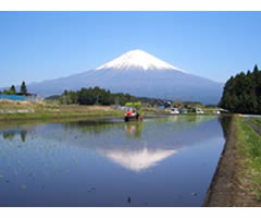
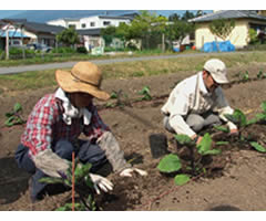
| Mt Fuji and our Konohana Farm | Mt Fuji from our rice paddies | Connected to neighbors, nature, and the net. |
 |
||
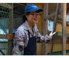
| The previous work I did was very interesting, but in the end I felt that practicing a sustainable lifestyle was more important than gaining a steady income.” – Michiyo Furuhashi |
FT13: SAGAMI FORESTS -- Urban Water Use and Conservation Forests of Sagami River - The interaction between Yokohama city residents and Dōshi village residents and the conservation of private forests
Cost ¥7,000 including lunch
Driving distance 160km
Duration 9 hours, 9:00am to 6:00pm
Capacity 40 persons
Coordinator Hiroshi Iioka, Yokohama City University.
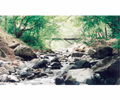
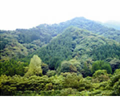
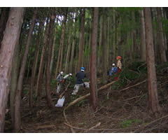
When Commodore Perry reached Japan in 1853-1854 with his mysteriously self-propelled “black ships,” Yokohama was a village with only 87 households. But the treaty of 1854 that opened Japan to foreign trade rapidly converted Yokohama into Japan’s most dynamic port city, and it grew rapidly. Because it grew via landfill, drilling wells would yield only water with unacceptably high saline content, so Kanagawa Prefecture hired a British engineer to build a modern waterworks that allowed Yokohama to expand. In 1887 H.S. Palmer’s modern waterworks system in the upper reaches of the Sagami river watershed began supplying clean water to Yokohama. Dōshi village, a composite of 6 hamlets that owned their forests in common, originally owned the forests and the water rights in the upper Sagami area. As part of its effort to convert common lands into national forests (in spite of the civil code’s legal protection of commons), after 1873 the Japanese government acquired Dōshi’s communal forest, then converted it into imperial forest in 1893, and then (after huge protest from forest commoners) into prefectural forest in 1914. When Yokohama moved its diversion weir to a tributary of the Dōshi River, the city of Yokohama purchased a large portion of Dōshi’s communal forest from Yamanashi prefecture. Today, due to this purchase, one third of the land located within the boundaries of Dōshi Village (in Yamanashi prefecture) is owned and managed by Yokohama City (in Kanagawa prefecture). In 1952 as a result of pressure, again from the national government on its campaign to “modernize” ownership of remaining commons, Dōshi village subdivided some of its remaining common forest into individually titled lands. Since then, individual households have found themselves unable to care for these private forests, due to aging and out-migration from the village. But for the last two decades, Yokohama city employees in the waterworks division have created teams of citizen volunteers from Yokohama who go to Dōshi to maintain these these private forests, in addition to the forests owned by Yokohama City as water conservation forest. Today Dōshi water is bottled and sold, with part of the profits going to the Dōshi Forest Foundation to be used in volunteer activities by Yokohama citizens and high school students to protect their water conservation forest in Dōshi. Over the last century, then, the common forests and water resources of Dōshi Village have in effect become the commons of Yokohama citizens as well. Participants in this field trip will learn about the process by which commons in the headwaters of a watershed became the common interest of millions, and will see how commons that were originally used to support village livelihoods are transformed into producers of environmental services, from clean water to environmental education, benefitting not just people of the original villages but also downstream city-dwellers.
 |
 |
 |
|---|---|---|
© 2012 Overall Organizing Committee of IASC2013